バックカントリー 富良野岳
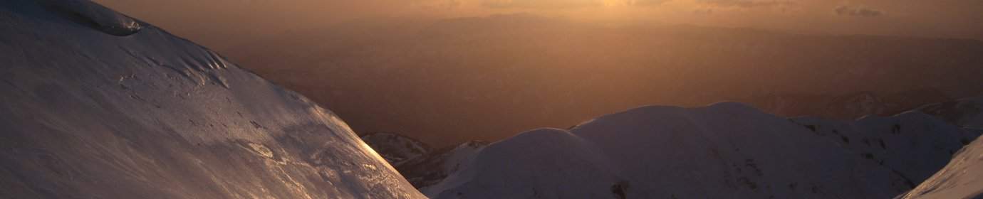
山岳ガイド研修会の最後の日の目的:北側からの富良野岳。今週の毎日のとおり、今日も強風。富良野岳の上部はよく凍っているから、アイゼンとピッケルを持ち、宿から出発。一日バックカントリーを楽しみ。
(English summary: Ski touring Furanodake from the north side. Since the upper parts are often quite hard, crampons and axe are recommendable)

最初道沿い200mくらい降りて、川を渡って、森に入る。森の中のオリエンテーションは難しい。古いトラックがなかったら、この凸凹な環境に迷いそうだ。Mさんの案内のお陰で、早く森から出て、富良野岳の北側の尾根をだんだん上がってくる。

1300mの高度で、スキーをやめて、アイゼンをつけて、歩いて登り続く。尾根を登ると、風がだんだん強くなる。上部で2mの身長の僕は、倒されないように、結構気をつけないといけなかった。強風なのに、さすがのガイドはこのチェレンジを楽しんでいる。

1710mの前山頂まで行った。そこから最初北北東の谷に1400mまで滑り降りた。その後もう一度尾根を登って、北北西の谷に滑り降りた。

最後に最初の尾根まで横断して、森の中道まで戻った。パウダーが多くて、楽しいバックカントリーだった。

宿で少し休憩したり、荷物の準備したり、してから、送別の時間になった。はじめて日本の山岳ガイド研修会に参加していた僕は、面白い四日間だった。そして、新しい友人ができてよかった。でも、僕に対して一番いいことは、5年間の大学だけの後、やっとまたガイドの世界に入って、好きな環境にいい時間を過ごした。皆さん、ありがとうございます!これから、アドベンチャーガイズと一緒にニセコへ!
他の写真を見たかったら、「International Mountain Guide Refreshment Course Hokkaido January 2015」の写真ギャラリーを見てください。
このツアーのトラックをここからダウンロードできるし、下記の地図でも見える。
Climbing first throught the forest, which is a bit difficult to orientate, followed by a ridge. Change to crampon at about 1300m and climb to the ante-peak at 1710. Skiing down on the NNE side to 1400m, then reascending to ski down the NNW valley, followed by a traverse to the original ridge and back to the street/hut. Track can be downloaded from here.

